Juwangsan National Park (주왕산국립공원)
Published 2003-01-03 Updated 2020-08-25 View 51447
We provide various information such as the website, contact information, usage information, and location (map) of Gyeongsangbuk-do Cheongsong-gun, Juwangsan National Park (주왕산국립공원) using public data of Korea Tourism Organization.
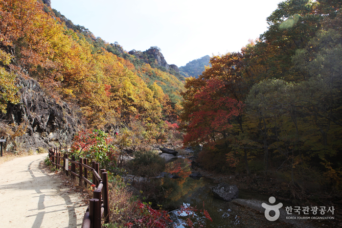
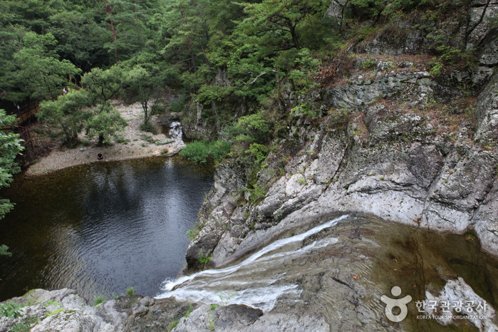
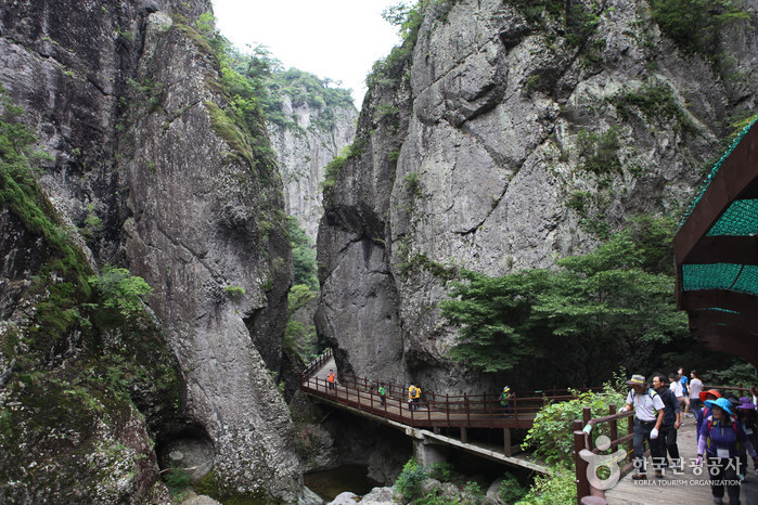
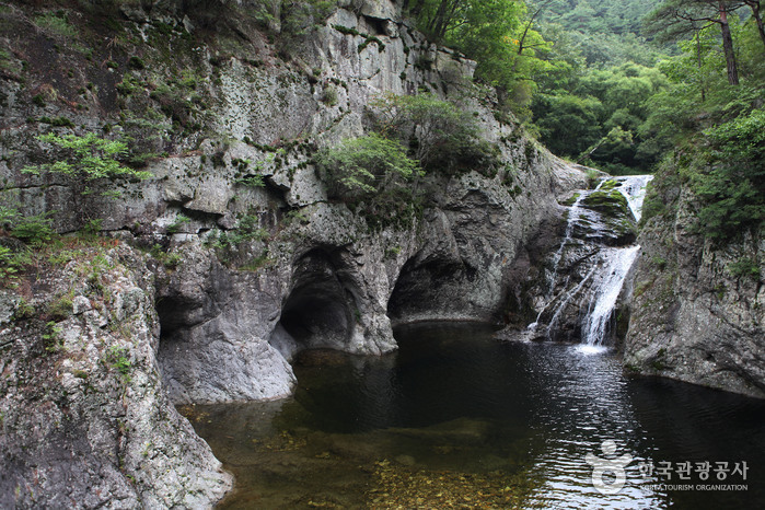
Juwangsan Mountain (720.6 meters) is located in the Baekdusan Mountain range, the backbone of the Korean peninsula. The mountain features deep valleys and many sheer rock cliffs to make it the third largest rocky mountain in the country. Juwangsan Mountain was recognized as a tourist attraction on May 30, 1972 and became the 12th national park a few years later on March 30, 1976. The park is quite small, filling in an area of just 105.582㎢ but is great for a leisure walk with walking trails in place along the valleys up to the waterfalls.
Juwangsan Mountain was called Seokbyeongsan Mountain during the Silla dynasty due to the many stone peaks jutting out, but has been called Juwangsan Mountain since the Unified Silla period. In addition to these tall rocky peaks, Juwangsan National Park also includes four waterfalls, caves, Daejeonsa Temple and other attractions for a comprehensive tourist site.
Telephone
+82-54-870-5300
Homepage
Detailed Information
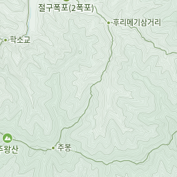
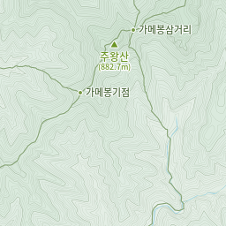
Hiking Course
[Gamebong Course (6 hr. 20 min. / 13.4 km)]
Sangui Parking Lot - Yongchu Falls - Hurimegi Junction - Gamebong Peak
[Juwang Valley Course (4 hr. / 8.8 km)]
Sangui Parking Lot - Yongchu Falls - Naewon-dong
[Jubong Peak Course (4 hr. 20 min. / 8.9 km)]
Sangui Parking Lot - Juwangsan (Jubong Peak) - Hurimegi - Sangui Parking Lot
[Jeolgol Cave Course (6 hr. 10 min. / 13 km)]
Jeolgol Visitor's Center - Gamebong Peak - Yongyeon Falls - Sangui Parking Lot
[Janggunbong Peak - Geumeungwangi Course (4 hr. 50 min. / 10.6 km)]
Sangui Parking Lot - Janggunbong Peak - Yongyeon Falls - Sangui Parking Lot
[Woroe Course 1 (5 hrs. / 12.3 km)]
Yeoloe Park Ranger Post - Dalgi Falls - Neogu Village - Geumeungwangi Junction - Janggunbong Peak - Sangui Ticketing (Daejeonsa Temple)
[Woroe Course 2 (5 hrs. / 12.3 km)]
Yeoloe Park Ranger Post - Dalgi Falls - Neogu Village - Geumeungwangi Junction - Janggunbong Peak - Sangui Ticketing (Daejeonsa Temple)
Mountain Not Access Period
* TBD by park rangers based on weather advisories, snow/precipitation levels, and other local conditions. Please visit the official website to check before visiting.
Natural Preservation Areas (closed to public)
* Giamgyo Bridge - Jahagyo (40,000㎡): until 2026
Night-time Hike Restriction Notice
To protect the environment and ensure the safety of hikers, hiking is prohibited at night (from sunset until two hours before sunrise).
Admission Fees
Fees apply to Cultural Heritage site
Available Facilities
* Camping Site - Sangui Campground
* Amenities - Management office, visitor's center, rest area
Restrooms
Available
Parking Fees
Small vehicles (less than 1,000cc): 2,000 won
Mid-sized vehicles (more than 1,000cc): 4,000 won (peak season: 5,000 won)
Buses: 6,000 won (peak season: 7,500 won)
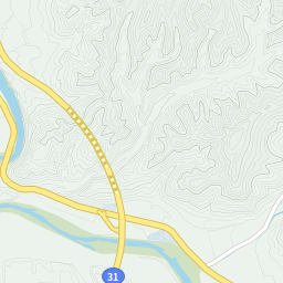
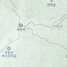
Address [Map]
169-7, Gongwon-gil, Cheongsong-gun, Gyeongsangbuk-do


Search
![Jusanji Pond [National Geopark] (주산지 (청송 국가지질공원))](http://tong.visitkorea.or.kr/cms/resource/84/2616884_image2_1.jpg)
Jusanji Pond [National Geopark] (주산지 (청송 국가지질공원))
Jusanji-ri, Cheongsong-gun, Gyeongsangbuk-do
Marnbauchon Garden (만바우촌가든)
5173-17 Gyeongdong-ro, Jinbo-myeon, Cheongsong-gun, Gyeongsangbuk-do
![Chalbanggong Head House [Korea Quality] / 찰방공종택 [한국관광 품질인증]](http://tong.visitkorea.or.kr/cms/resource/07/2528907_image2_1.jpg)
Chalbanggong Head House [Korea Quality] / 찰방공종택 [한국관광 품질인증]
23-8, Songsogotaek-gil Pacheon-myeon, Cheongsong-gun, Gyeongsangbuk-do
![Chungwon Gotaek [Korea Quality] / 청원고택 [한국관광 품질인증]](http://tong.visitkorea.or.kr/cms/resource/32/2528932_image2_1.jpg)
Chungwon Gotaek [Korea Quality] / 청원고택 [한국관광 품질인증]
3 Songsogotaek-gil, Pacheon-myeon, Cheongsong-gun, Gyeongsangbuk-do
Seobyeok Historic House (서벽고택)
22-2, Jungdeul 2-gil, Cheongsong-gun, Gyeongsangbuk-do