Gwanggyosan Mountain (광교산)
Published 2003-10-27 Updated 2020-07-08 View 20079
We provide various information such as the website, contact information, usage information, and location (map) of Gyeonggi-do Suwon-si, Gwanggyosan Mountain (광교산) using public data of Korea Tourism Organization.

Gwanggyosan Mountain located north of Suwon protects the city from the cold wind blown from the north. Previous name of Gwangaksan Mountain was renamed during the Goryeo period when King Taejo changed it to the current name. located between the Gyeongbu expressway and the road that connects Seoul and Suwon, the mountain is part of the Sanggwanggyo-dong. The mild and gentle ridge of the mountain makes it a perfect trail to walk on. As one of the 8 attractions of Suwon, the view of snow-covered trees is a must-see. To preserve the beauty of the trail and the nature, since 2003, the mountain is closed to public every three years.
Telephone
+82-31-228-4574
Homepage
www.suwon.go.kr (Korean, English, Japanese, Chinese)
Detailed Information
Hiking Course
* Kyunggi university→Hyungjae Bong→Siru Bong→Jiji dae(10.2km / 4hr)
* Munamgol→Baeknyun fountain→Hyungjae Bong→Siru Bong (3.4km / 2hr)
* Yangji nongwon→Ttokki jae→Siru bong→Tongsin dae→Jiji dae(6.4km / 3hr) and more
Restricted Mountain Areas
* Refer to the website. (hiking.kworks.co.kr)
Address [Map]
Sanggwanggyo-dong, Suwon-si, Gyeonggi-do
Search
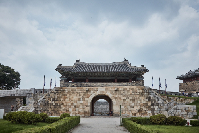
Hwaseomun Gate (화서문)
334, Jangan-dong, Paldal-gu, Suwon-si, Gyeonggi-do
![Playkiz - Lotte Buyeo Branch [Tax Refund Shop] (플레이키즈 롯데부여)](http://tong.visitkorea.or.kr/cms/resource/30/2883430_image2_1.jpg)
Playkiz - Lotte Buyeo Branch [Tax Refund Shop] (플레이키즈 롯데부여)
2F, 10, Docheong-ro, Yeongtong-gu, Suwon-si, Gyeonggi-do
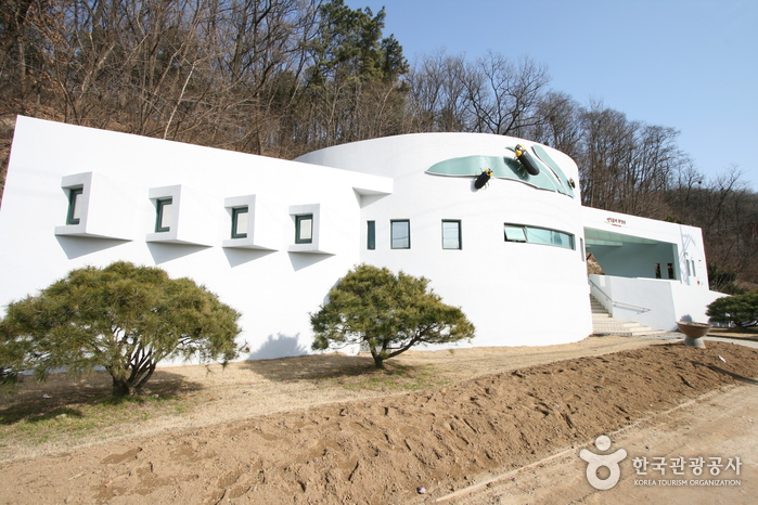
Firefly Restroom (반딧불이화장실)
166, Gwanggyosan-ro, Jangan-gu, Suwon-si, Gyeonggi-do
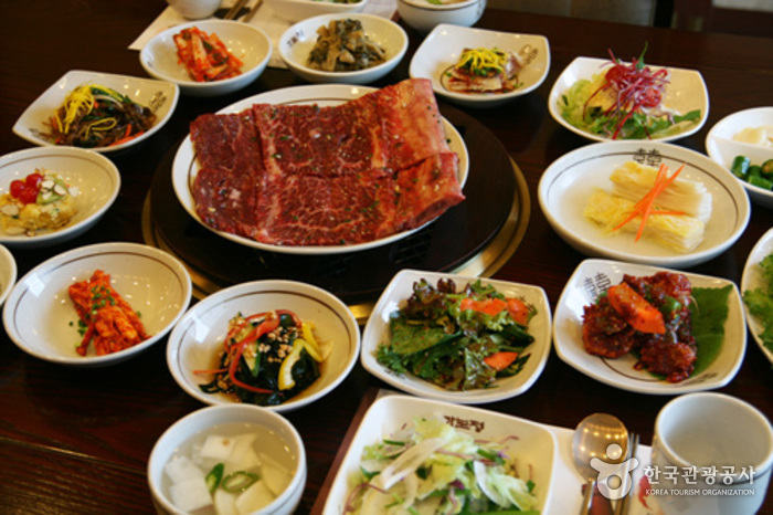
Kabojung (가보정)
282 Jangdari-ro, Paldal-gu, Suwon-si, Gyeonggi-do
![N.Cat [Tax Refund Shop] (못된고양이)](http://tong.visitkorea.or.kr/cms/resource/61/2891061_image2_1.jpg)
N.Cat [Tax Refund Shop] (못된고양이)
2F, 930, Gyeongsu-daero, Jangan-gu, Suwon-si, Gyeonggi-do