Bongnaepokpo Falls [Ullengdo & Dokdo National Geopark] (봉래폭포 (울릉도, 독도 국가지질공원))
Published 2004-06-30 Updated 2024-02-23 View 13284
We provide various information such as the website, contact information, usage information, and location (map) of Gyeongsangbuk-do Ulleung-gun, Bongnaepokpo Falls [Ullengdo & Dokdo National Geopark] (봉래폭포 (울릉도, 독도 국가지질공원)) using public data of Korea Tourism Organization.
![Bongnaepokpo Falls [Ullengdo & Dokdo National Geopark] (봉래폭포 (울릉도, 독도 국가지질공원))0](http://tong.visitkorea.or.kr/cms/resource/24/1893624_image2_1.jpg)
![Bongnaepokpo Falls [Ullengdo & Dokdo National Geopark] (봉래폭포 (울릉도, 독도 국가지질공원))1](http://tong.visitkorea.or.kr/cms/resource/25/1893625_image2_1.jpg)
![Bongnaepokpo Falls [Ullengdo & Dokdo National Geopark] (봉래폭포 (울릉도, 독도 국가지질공원))2](http://tong.visitkorea.or.kr/cms/resource/26/1893626_image2_1.jpg)
![Bongnaepokpo Falls [Ullengdo & Dokdo National Geopark] (봉래폭포 (울릉도, 독도 국가지질공원))3](http://tong.visitkorea.or.kr/cms/resource/27/1893627_image2_1.jpg)
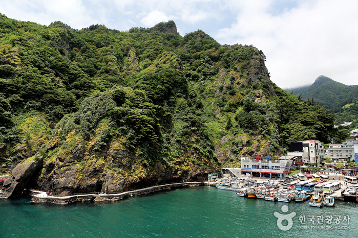
Bongnaepokpo Falls is 30-meter high waterfall with three-tiers formed by differential erosion. The lower two tiers were formed by eroded agglomerate rocks and the highest tier is trachyte. Bongnaepokpo Falls is used as the main source of water supply on Ulleungdo Island. Tourists can enjoy a walking path that connects Bongnaepokpo Falls’ management office to the waterfall, a natural wind hole that blows out cool air, and a forest retreat to relieve stress. Bangnaepokpo Falls and the surrounding area are not only perfect as a nature attraction, but also highly valued for the rich forest ecosystem and geological features.
Telephone
+82-54-790-6182
Homepage
Detailed Information
Admission Fees
Individuals - Adults 2,000 won / Teenagers 1,500 won / Children 1,000 won
Groups - Adults 1,500 won / Teenagers 1,000 won / Children 500 won
* Adults (ages 20-64) / Teenagers (ages 13-19) / Children (ages 7-12)
* Free: Senior citizens (ages 65 & older), preschoolers (ages 6 & younger)
* Groups - 30 people or more
Address [Map]
Dodong-ri, Ulleung-eup, Ulleung-gun, Gyeongsangbuk-do


Search
Ulleungdo Island (울릉도)
236, Taeha-gil, Ulleung-gun, Gyeongsangbuk-do
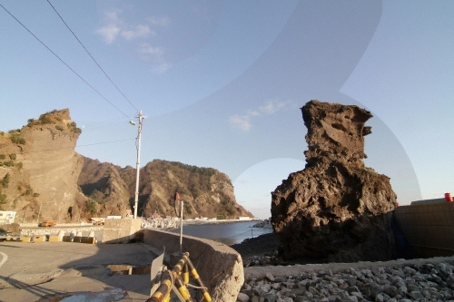
Sajabawi Rock (사자바위)
Namseo-ri, Ulleung-gun, Gyeongsangbuk-do
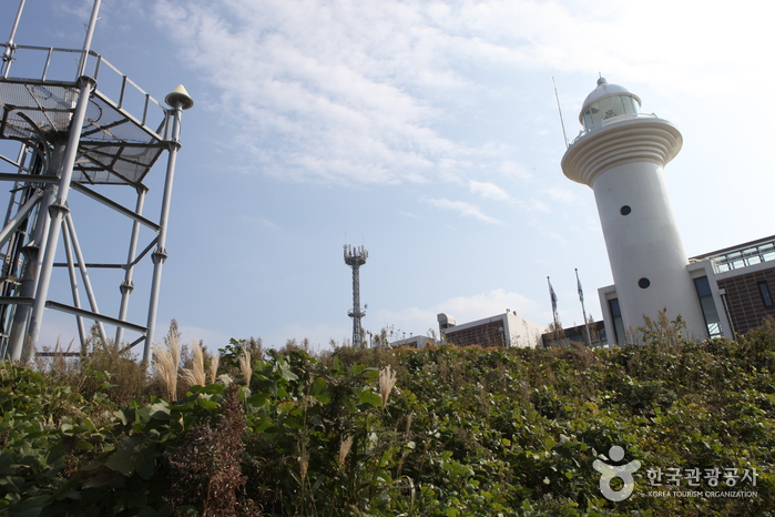
Ulleungdo Lighthouse (울릉도 등대 (태하등대))
188, Taehadeungdae-gil, Ulleung-gun, Gyeongsangbuk-do
![Elephant Rock [Ulleungdo-Dokdo National Geopark] (코끼리바위 (울릉도, 독도 국가지질공원))](http://tong.visitkorea.or.kr/cms/resource/79/2499379_image2_1.jpg)
Elephant Rock [Ulleungdo-Dokdo National Geopark] (코끼리바위 (울릉도, 독도 국가지질공원))
Hyeonpo-ri, Buk-myeon, Ulleung-gun, Gyeongsangbuk-do
Ulleung Yakso Sutbul Garden (울릉약소숯불가든)
556, Ulleungsunhwan-ro, Ulleung-gun, Gyeongsangbuk-do