[Ganghwa Nadeul-gil Course 7] Setting Sun Trail ([강화 나들길 제7코스] 낙조보러 가는 길)
Published 2014-08-04 Updated 2022-12-29 View 23723
We provide various information such as the website, contact information, usage information, and location (map) of Incheon Ganghwa-gun, [Ganghwa Nadeul-gil Course 7] Setting Sun Trail ([강화 나들길 제7코스] 낙조보러 가는 길) using public data of Korea Tourism Organization.
![[Ganghwa Nadeul-gil Course 7] Setting Sun Trail ([강화 나들길 제7코스] 낙조보러 가는 길)0](http://tong.visitkorea.or.kr/cms/resource/23/1895223_image2_1.jpg)
![[Ganghwa Nadeul-gil Course 7] Setting Sun Trail ([강화 나들길 제7코스] 낙조보러 가는 길)1](http://tong.visitkorea.or.kr/cms/resource/24/1895224_image2_1.jpg)
![[Ganghwa Nadeul-gil Course 7] Setting Sun Trail ([강화 나들길 제7코스] 낙조보러 가는 길)2](http://tong.visitkorea.or.kr/cms/resource/25/1895225_image2_1.jpg)
![[Ganghwa Nadeul-gil Course 7] Setting Sun Trail ([강화 나들길 제7코스] 낙조보러 가는 길)3](http://tong.visitkorea.or.kr/cms/resource/26/1895226_image2_1.jpg)
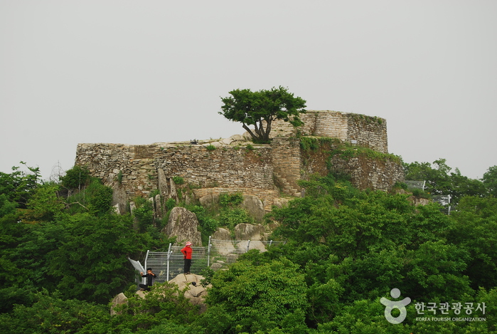
The Ganghwa Nadeul-gil Trails are a collection of walking paths along the coast of Ganghwa Island that connect the watchtowers and and walls of Ganghwasanseong Fortress, as well as royal tombs and other historically significant sites from the Goryeo dynasty that dot the island.
[Ganghwa Nadeul-gil Course 7] Setting Sun Trail
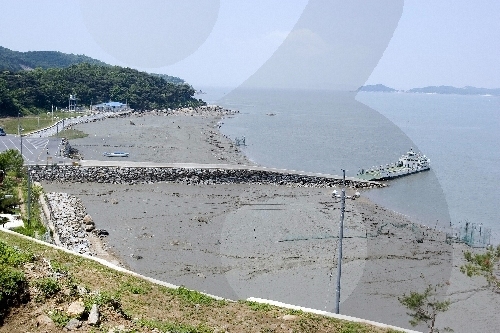
Course 7 stretches over a 20.8-kilometer-long loop from Hwado Parking Lot to Mud Flat Research Center and back. The trail leads through a tunnel of green leaves before opening out onto the mud flat. The mud flat is one of the world's top five mud flats and presents a beautiful view of the ocean and mountains. Bird-watchers will love the chance to see migratory birds fly through each winter.
Telephone
+82-32-934-1906
Homepage
www.nadeulgil.org
cafe.daum.net/vita-walk
Detailed Information
Tourism Course
[Ganghwa Nadeul-gil Course 7] Setting Sun Trail
Length: 20.8 km
Travel time: 6 hr 40 min
Address [Map]
24, Cheonghadong-gil, Ganghwa-gun, Incheon
Search
Seonsu Port (Hupohang Port) (후포항 선수포구)
Haeannam-ro 2903beon-gil, Ganghwa-gun, Incheon
![[Ganghwa Nadeul-gil Course 6] Birthplace of Hwanam Trail ([강화 나들길 제6코스] 화남생가 가는 길)](http://tong.visitkorea.or.kr/cms/resource/27/1895227_image2_1.jpg)
[Ganghwa Nadeul-gil Course 6] Birthplace of Hwanam Trail ([강화 나들길 제6코스] 화남생가 가는 길)
24, Cheonghadong-gil, Ganghwa-gun, Incheon
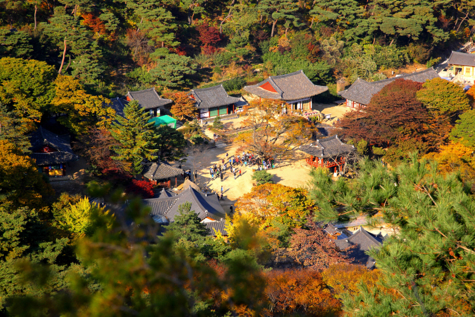
Ganghwa Jeondeungsa Temple (강화 전등사)
37-41, Jeondeungsa-ro, Ganghwa-gun, Incheon
Ganghwa Seonwonsa Temple Site (강화 선원사지)
222, Seonwonsaji-ro, Ganghwa-gun, Incheon
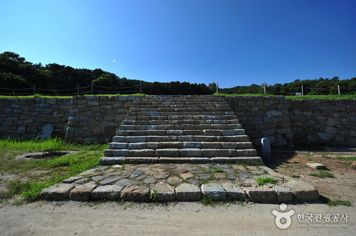
Chamseongdan Altar (강화 참성단)
Heungwang-ri, Ganghwa-gun, Incheon